Turtle Islands Odessey

The Turtle Islands lie tantalisingly close to Sherbro Island, but are a world away from mainland Sierra Leone and certainly seem that far when trying to visit.

Having arrived in Bonthe [see previous posts about Bonthe and the journey there], we discussed the trip to the Turtle Islands with the boat driver to determine how long it would actually take, having heard several different estimates. We were assured that if we left early (7am) the tide would be right to reach the islands in about an hour an a half. We would have to wait there an hour or so for the tide to ebb, then we could return in similar time. So we agreed and set our alarm clocks.

P1180852We departed just after dawn broke with the rising sun reflected by the glassy water. Our boat created a white wake as we sped past sleepy settlements on the low lying shoreline. Small groups of houses appeared, preceded by the sight of tall trees above the normal height of the mangroves. In some places we could just see a dark entrance way into the mangroves, wide enough for canoes,  but the settlement remained hidden by the foliage.


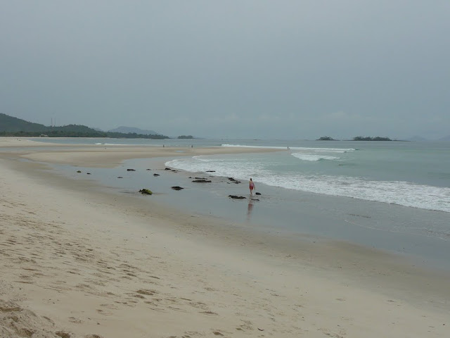
After the predicted time, our first view of the islands as they emerged on the horizon.

This is the tiny sand bar known as Nyangei, which is an incredibly high-density settlement on a narrow slither of sand, shown as N on the satellite image below and in close-up. There are over 80 houses on this tiny island. We approached from the north and first tried to go past the west side but were prevented by the emerging football field. We could see the goalposts sitting in the sea off the bottom left corner of the sand, but within half an hour it would be a dry pitch, so we had to retrace our route to avoid being marooned, and passed the other side of the island.

Our first stop was on Bakie – lower centre of the image above [click on it to magnify]. At least half the population came to greet us on the beach and the head man showed the community the cash gift we gave him, before pocketing it for safe keeping. After a refreshing coconut picked for us from a nearby tree, we walked around the island, guided by adults but followed by a posse of children; those with shoes having the advantage, while those without ran from shady spot to shady spot to avoid burning their soles.

P1180865

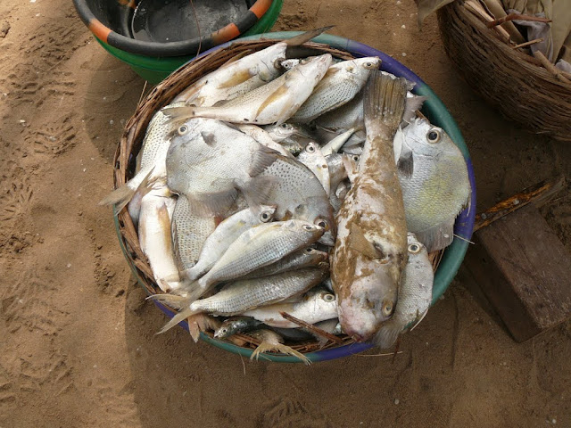
Almost all the huts were built from natural materials, with a stick frame filled in with mud from the inside and a thatched roof. Dotted around were small, roofed structures with ladders for access by poultry (centre of photo). Further back in the village were smoke-filled huts where the daily catch is preserved before being transporting to the mainland. The art (or science?) of smoking has been lost in some parts of the country and there have been instances of fish rotting when not correctly smoked.

P1180869

Shell debris littered the whole area showing how important a resource this is – we later saw a large pile of dried cockles, also ready for trading.

Following the school teacher, we went to see the primary school (photo below) which serves about 100 children; a blackboard on each side so two classes run at once. The older children have to go to Bonthe or the mainland for further schooling. This is a community school not supported by the government.

P1180870

Having finished the village tour we  were shown the Bakie Guest house which is marked on Google Maps and described in the Bradt Guide, but sadly is no longer habitable; the roof was removed by a storm and the building now looks decidedly dilapidated.

We walked from the guest house south along the beach to the end of the sand and unfortunately found ourselves separated from a further beach by a swampy inlet. Later it was passable and the whole coastal stretch around to the Atlantic was available.

It was then time to wait for the tide to flow out, before we could make our return journey, so we sat under a palm tree and relaxed as the villagers went about their business, cooking, playing, hairdressing, mending nets and sitting chatting. On a second pass a long the beach with the vague idea of having a swim, we realised that the stretch of sand just outside the village was in fact also the local toilet, so we passed on quickly and only paddled much further down. The water was not inviting as it shelved slowly and was not well tide washed. It appeared muddy and stirred up easily, so that, and the jelly fish beyond, kept us in the shallows.

P1180866

Once the tide was deemed right, we said our farewells and set sail across the bay to the next island of Yele where we went through the same routine; greeting the head man (with cash), touring the village, visiting the school and being shadowed by dozens of children.

yele

The settlement on Yele was slightly larger than Baki and had more concrete houses, plus a substantial school building (built a few years ago with help from the Bonthe council); the shiny roof at the bottom of the image.

The soil on these islands is mostly sand and very little grows apart from scrubby vegetation, some fruit trees and plenty of mangroves. In the villages a few people had small vegetable patches, fenced to protect them. The villagers seem to rely heavily on the sea to provide what they need and trade with Bonthe and the mainland for what they lack. It is a remote existence, certainly far from the madding crowd. I am sure if you slung your hammock or pitched your tent, you could spend a night under a canopy of stars away from the frenzy of modern life, but we preferred to return to a comfortable bed.

Most of the boats traversing the area between the islands were powered by poles punted through the shallow waters. It was these shallows, which you see a hint of in the satellite images, which slowed our return journey, the boat having to aim for the deeper parts and creep over the shallowest. Once out into the main river, progress was faster, but it took a good deal longer coming back, not helped by having to conserve fuel until another boat could rendez-vous with us to bring further supplies of diesel.

We had made our trip to the Turtle Islands. We didn’t see any turtles, but had not expected to. Several species are seen hereabouts and nest on these southern beaches. The remote location should be reasonable protection for their breeding sites. They are legally protected in these waters, but with little enforcement, whether the ban on killing them or poaching eggs is effective or not, who knows?

Was the trip worth it? On balance, yes, it was interesting to see these remote islands, which seem to float like bubbles from the tip of Sherbro Island, and the people who inhabit them. So long as your expectations are low, you will not be disappointed.

P1180859


Kent, Western Peninsula, Sierra Leone

The usual reason to visit Kent is to catch a boat to the Banana Islands, about half an hour away, but we decided to have a look around the village’s historic sites.

P1180548

Our first impression of the village was not the best as we parked beside an earthen football pitch, strewn with plastic debris. Some men loitering nearby became a little belligerent when we said we just wanted to walk around the village, but later were more amenable and offered to show us around.

Boats are launched from both sides of a sandy isthmus which joins the village to a rocky outcrop. Fishermen were busy mending their nets. The Banana Islands floated hazily on the distant horizon.

From the fishing port, a sweep of pristine sand curves towards the hills. This beautiful beach was deserted. The lack of facilities and lack of any road direct to the beach must deter visitors, although there are a couple of resorts at the far end. The superstitious might be put off by the presence of a graveyard just behind the beach. A beautiful location to be laid to rest, marred slightly by the ubiquitous plastic debris blowing around behind the beach. Men were clearing the beach, but seemed to dump their collection behind the sand.

Between the village and the fishing port is the remains of the old slave baracoon, marked by a laterite wall, in places being absorbed back to nature. In the middle is the current primary school built directly on what was the holding pen for slaves – now only visible through small slits which allowed a minimum of fresh air into the space (the black section of the wall). The small door was barred and locked, but it was obvious that the height of the inner chamber was less than an adult would need to stand. The quarters above, now replaced, were used by the slave traders.

Back in the village we were shown other remains of old buildings used by slave traders, who collected slaves from the interior here, before transferring them to the Banana Islands or other trading points such as Bunce Island where they would be loaded on ocean going vessels to cross the Atlantic.

Down a track, to another part of the shore we found an abandoned sea-pool and derelict house. This was the seaside home of Siaka Stevens, former president.

The Stevens family still owns the site and a building next door, which was at one time a library, but is being renovated as a private house.

The church service was in full swing as we passed by and the two policemen on duty at the old colonial police station were busy doing their washing.

So, having thanked our guide we left Kent content that we had seen the historic sites. We returned past Burreh beach to the less visited John Obey. Here at Tribewanted, we ordered lunch then walked the length of the approximately 2km pristine beach, which is backed by a large lagoon preventing access from the peninsula road. At the far end of the beach a private dwelling has the only other access to the road.

Tribewanted aims to develop sustainable tourism in cooperation with local communities. Guests stay and get involved in building the sustainable infrastructure. Here at John Obey, one of the projects was the adobe houses inspired by CalEarth made from local materials and designed to have natural air conditioning with intakes low down on the walls and outlets high up (using the principle of warm air rising).

P1180574

We went into the larger dome (not pictured) and found, in the middle of the day, it was indeed cool inside. There are also two wooden huts for rent, with bucket showers. The toilets on site are composting in line with the sustainable ethos.

Our lunch of grilled fish, chipped sweet potato and papaya was served overlooking the sea at a shady table. Nearby hammocks swayed in the breeze. It’s certainly a peaceful spot in which to chill for a few hours or indeed to stay overnight.

P1180592


Banana Islands, Sierra Leone

Just off the southern end of the peninsula, on which Freetown is the northern tip, the Banana Islands spill like drops from a glass into the Atlantic. The longest island is about 6 kilometres long and is the site of the ‘capital’ Dublin. It is joined to the smaller island, Ricketts, site of the second settlement with the same name, by a rocky bridge and beyond that is the tiny uninhabited Mes Mieux. A population of about 1000 live in the two villages. Although it is possible to walk between the two, it is easier to travel by boat.

Many visitors take a local boat from Kent, the nearest point on the mainland, but we went by speedboat from Freetown in around an hour and a half, bouncing over the relatively calm sea. We stepped into the shallows of one [left] small sandy beach and walked along dusty forest paths to another beach [right], our lunch spot. Here we were met by our guide, the schoolmaster/pastor who took us on an historic tour of the island.

[click on images for bigger version]

First stop was an old well, still one of the water sources. Our guide seemed a little confused about its age, claiming it was 2000 years old, built by the Portuguese, but later correctly saying the Portuguese were here in the 15th to 16th centuries. Next was a fortification built some way behind the beach on which we had landed. Three small cannons, one bearing the date 1813, lay half buried in the ground which was raised by a stone wall from the surrounding area. It seemed too far from the shore to be much of a defensive position, but nearby was another fortification nearer the shore and slightly elevated. Here, we were told, were the slaver’s buildings where they selected slaves suitable for transportation. Those too old or sick were cast into a pit a short way off – although this pit could be the remains of a well as suggested by Sierra Leone Monuments Commission.

On a lighter note, we were taken to the place where oral tradition has it that John Newton had a divine revelation. Newton was abandoned by a naval vessel in West Africa and given, by the slaver Amos Clow, to his mistress, who enslaved Newton on Plantain Island. He wasP1180440 rescued in 1748 by a ship his father had sent. On the return voyage, a storm and subsequent delivery there-from, caused Newton to convert to Christianity, but he continued in the slave trade until 1754 – possibly during this time visiting the Banana Islands again and seeing the light? He then became an Anglican clergyman who influenced Thomas Scott, co-founder of the Church Missionary Society (CMS) which was later closely involved in the early settlement of Freetown. He co-wrote numerous hymns, probably the most famous of which is known as ‘Amazing Grace’. He also counselled William Wilberforce to remain in parliament and do God’s work there. Newton wrote a pamphlet ‘Thoughts upon the slave trade’ which he sent to all MPs during the campaign for abolition of the slave trade, describing the horrors which he had personally witnessed. He died in 1807 shortly after the passing of the Slave Trade Act. Following abolition the Royal Navy set up posts along the West African coast from which to board slaving ships. Banana Islands was one of these. The ‘recaptives’ were then taken to Freetown and settled in the new Colony, set up by the British Government in 1808 so that slavers could be tried there.

In front of this small white church is a large bell, cast in Sheffield in 1881, which is still used to summon the faithful. The school, nearby, uses an empty gas cylinder hanging from a tree to call the children. Beside the church are the ruined walls of a former building which was too big to maintain. The sad state of the current building with its sagging ceiling and benches crumbling from termite attack, seem to indicate the problem remains, despite some support from the diocese of Chichester.

P1180433

Termite mound beside forest path

The complex society of termites became the passion of another colourful character who lived on the Banana Islands for four years from 1771, Henry Smeathman. He collected specimens for gentlemen scientists like Sir Joseph Banks and Dr John Fothergill, but turned from botany to entomology and became an expert on termites. He later made a living lecturing about them and is famous for his illustrations – see them here. Not unlike a mound we passed and the ones we saw at Picket Hill. Smeathman cultivated a vegetable garden and also reports playing golf in the cool of the afternoon. He was later instrumental in the founding of Freetown, by suggesting the location as a good one for a new colony of freed slaves.


The forest tracks took us past a variety of dwelling across the island to the cemetery, the resting place of many from centuries past. Mostly overgrown, some family areas are still used and well tended. Graves can be re-used after seven years.

The fishing port is on the south coast down a stone-lined path which reaches the beach between two enormous cotton trees. It is a picturesque spot with colourful fishing boats, sand, azure sea and distant rocks covered in birds, which we now know are ‘white birds’ thanks to our guide.

The ‘pink church’ was a large building, home to a flock of swallows nesting inside the roof and swooping between the rafters and open windows. Some interesting plaques remember John Campbell, sunk by enemy action in 1916, and Mrs Comfort Campbell (63) who died in a raid in 1898.

Back at the beach we swam in the warm waters and had fresh fish for lunch. Our entertainment from the shady terrace was weaver birds preparing new nests. Quite amazing to see them arrive with a long strand of green vegetation and weave it into place – all with no hands!

The return trip took us closer to shore, a great perspective on the peninsula from which we have so often gazed out to sea. The alarming rate of deforestation is clearer still from this vantage point.

As the sun set, we rounded Cape Sierra Leone with its old lighthouse, the western most point of the mainland of Sierra Leone and one of the points on the African continent closest to South America.


Sunday stroll

Finished path along beach road

Finished path along beach road

Lumley beach is a favourite walking spot, not only of ours, but this morning it seemed the whole of Freetown was there. Well, to be more accurate, most of the male population – I guess the women were the ones in the darkened interior of the church from which we could hear the amplified preaching across the road.

Section of path under construction

Section of path under construction

Footballers were out in force, but the tide was high up the beach limiting the room for pitches, so the numerous teams were taking advantage of the new pathway along the road to do some training jogging. The path was heaving! (so busy in fact that I didn’t take any photos at this point!) and it was 99% male, mostly young and slim, but some older men and a few carrying extra kilos. I think they need a campaign ‘girls can play football too!’ For some, the walking and jogging is not sufficient so they also lift weights at the beach side gym. No air-conditioned cooling here.

P1180112

The beach gym


It is one of the few areas left on the beach side of the road which have not been levelled. The beach side bars are a thing of the past. The vision is for the beach to be a leisure facility and tourist destination, with all business kept on the other side of the road. The gym and the fish market are that remain.

P1180111

A broken concrete dinosaur and bottle are all that remain of this beach bar

The path is a great improvement and seems to be a factor drawing people to the area. At the far end of the beach there was a large crowd in the sea, which is quite an unusual sight. Not many locals swim for leisure. In the distance we could see the crane looming over the new hotel being built on the promontory. There is real hope that tourists will return.

P1180096 (2)

This beach, so close to the city should certainly be an attraction, as long as it can be kept clean.  The improved road and path make it more accessible but also more crowded. The solar powered street lights mean it is one of few areas lit at night, and so is particularly popular on weekends in the evening as a place to hang out. But in the daytime not everyone is here for exercise – this guy was enjoying a more leisurely Sunday than his compatriots.

P1180114 (2)

Empty pockets

Walking along a beach anywhere in the world, it is hard for me to resist picking things up. Usually pretty shells, maybe an interesting piece of driftwood or a particular pebble with distinctive colouring or shape.  However, it struck me this morning, on what has become our usual weekend walk beside the sea, there is very little of interest to pick up on Lumley beach – much to the relief of my husband who has to contend with the various rescued items rattling around in the car for weeks, or displayed somewhere around the house.

P1090946

This morning the tide was coming in, slowly creeping up the smooth sand.  Plenty of footprints showed that many walkers and joggers had been and gone before us. The advancing waves meant that we were more or less following the line of modern detritus being gradually nudged up towards that left by the last tide.  Plastic bottles abound – I’m not sure why people who recycle them are not out combing the beach every day – plastic pouches from drinking water (the most affordable way for most people to buy clean water), and miscellaneous shapes of polystyrene and foam are ubiquitous.  For the past two weeks there have been oranges all over the beach. Yes, I mean oranges the fruit, in various stages of decay as they have been apparently bobbing around in seawater and sand for sometime.  I wondered if they had washed off a passing ship, but as most cargo is now containerised, this seems unlikely. More probable a local boat heading for a nearby market had lost them. Anyway, they have given me something to kick as we pass by.

Less pleasantly, this morning we saw two dead dogs,their legs unnaturally stiff and pointing skyward like upturned tables, their bellies distended. On our outward walk they were ignored by all, but as we returned, a vulture was hesitantly hopping around one corpse. We earlier saw a flock of ‘Minista birds’ (black and white pied crows) all trying to perch in a palm tree. It was a strange site to see so many together and all trying to find space on the flimsy palm fronds.  I wonder whether they had spotted the corpses, but there were too many footballers around to let them feel comfortable landing.  They flew off somewhat sinisterly, in a banking mass and headed inland.

Shoes are the other things which litter the shore.  Some are broken, but others look perfectly fine, if only you could locate the pair.  How do people lose so many shoes?

What does come as a refreshing surprise is to spot something natural among the flotsam. The occasional small stalk of seaweed or a leaf! But little else appears.  We did come across three children digging in the wet sand the waves were washing.  The youngest, a boy, was carrying a small plastic bowl with a little seawater in it and about two dozen small purple bivalves. Just past where they were digging I found one laying on the sand.  As you can see, they are very small and I imagine they would need to keep at their work for sometime to have enough for a meal. The boy was looking forward to eating them. He did tell me the name, but Google has failed to help me identify them.  Any ideas?

P1100708

P1100709

We left them to it and finished our walk, but with the exception of this small shell, once again I had finished my walk with empty pockets.

Lumley lobsters

The tide was coming in as we walked along Lumley Beach this morning. In fact it was well up the beach so we had no smooth sand to walk on. While dodging (walking in trainers because of the rubbish on the beach) the odd, extra-strong, incoming wave we wondered if the fish came in with the tide. One line of fishermen were  just beginning the long, slow hauling in of nets: one man sitting at the back of the line coiling the rope, the others leaning into the beach as they pulled.  As we approached more men joined the line, but the pile of rope was small so we knew they had a long job ahead of them.

One of the local team football coaches jogged past us just before we reached the fish market, giving Martina a wave of recognition. The German Embassy have donated equipment to the amputees’ football teams. We admired a pile of sandy fish just being scooped from the nets into baskets, so decided that maybe the incoming tide had helped the catch. Martina was hoping for lobster.  Yes, we were told, come see what we caught.  So we followed. The fisherman told us they came from far out to sea, but we are not sure how they catch them.

So here is Martina with the two monstrous, very much alive and kicking, lobsters for which she negotiated a good price.

And these are the two which were left for another customer. Certainly no doubts about their freshness!

Selling fish is normally women’s work and the women were keen for us to see their wares:

Barracuda, snapper and grouper

Blue-legged crabs

assorted fish (OK, I forgot their names!)

Procedure for buying fish: select fish you like the look of and ask the price, receive the price with a laugh and say how expensive it is, wait for next offer, or make a counter offer as the vendor will say, ‘how much you give me?’  Half initial price, wait for her counter offer, then agree somewhere in between. More fun than simply accepting the price in your local supermarket or fishmonger! No weights and measures in sight, nor any price per kilo, strictly look and judge by size. Then ask for fish to be gutted and descaled, which is swiftly done with a large knife and the fish washed in fresh seawater. The entrails are discarded into the waves.

behind you can see a clean-up crew in action

The fish this morning were so fresh that they hadn’t made it into the baskets of ice under the umbrellas where we usually select our fish.

The baskets are lined with blankets, then filled with crushed ice and the blankets layered over the top. Old tyres make handy insulating tables!

The women while away the time between customers in the shade and a toddler sleeps soundly beside the fish.  The basket in the foreground was ready for market and soon after this, one woman hoisted it on to her head (with a twisted scarf between her head and the basket) and set off to sell her fish. She declined to be ‘snapped’ (photographed).

We completed our return walk and sat together to drink a large bottle of water.  We were joined by these duiker (small deer), that live in the resort, which proceeded to give Ann a ‘pre-shower spa treatment’ – licking her legs thoroughly with slightly rough tongues.  We decided they probably were after the salt! Post walk we were all rather hot and I would say ‘lobster red’, except this seems insensitive to the poor creatures which were, at that point, still oblivious to their coming fate.

Bump to the beach

When everyone tells you the same thing, I guess you should believe them. Before we came to Sierra Leone the three things everyone told us were: lovely people, fantastic beaches and delicious seafood – on the first two counts they were right (seafood yet to be tested)! The peninsula beaches are wonderful! White, squeaky sand, warm ocean and very few people – this is my idea of a beach.

Image

This is Tokeh beach, looking north

Although only about 20 kilometres, it took nearly an hour to drive to Tokeh. The road is another of the ongoing construction projects to improve the road infrastructure. This project has been ongoing for over 10 years – dynamiting, leveling and bridge building – but still much to be done. Several sections have reached the ‘leveled’ status, many have not.  It will eventually be dual carriageway, but for now, the traffic often has to share the same side, dodging lumps and bumps. The last section to Tokeh turns inland away from the new construction. It rapidly becomes lumpier and bumpier and is definitely 4×4 only – saloon cars simply would not make it.  It crosses three narrow bridges, just wide enough for a single vehicle. Therefore, it is necessary to give way to oncoming trucks, of which there is a regular stream. They are heading south empty, and back north laden with sand which is being ‘mined’ from some of the beaches. This is potential ecological disaster!

Fortunately no sign of mining on Tokeh, where we set ourselves down under a thatched umbrella at the top of the white beach, which widened as the afternoon wore on and the tide receded. Just offshore is the remains of the helipad which once brought the jet-set from Lungi airport to the luxurious Club Med. The final few yards to the beach were along a wooden jetty – now long gone. Sadly Club Med was destroyed during the war.

Part of the remains of Club Med – to see how it was click

At No.2 River Beach, later in the afternoon, we were told how the local men hid in the bush while the rebels were in the area.  They had started their community staffed and run beach resort in 1995, so when the rebels arrived they buried as much as they could in plastic lined holes on the beach, then fled. They continued to fish and try to protect their village, but had taken their women and children to the Banana islands nearby for safety – seen in the far distance of this photo, on right hand side.

No. 2 river beach, looking south towards Tokeh beach

The beach area is still run for the benefit of the local community, who charge an entrance fee and hire out tables, chairs, beach huts, barbecue facilities and overnight accommodation. They also run a restaurant and bar and employ ‘security’ to keep those not part of the resort away from the beach. There are some community run craft stalls beside the parking area. Definitely a venue for future days on the sands.

We walked south along the clean, white sands of Tokeh past the fishing village where the latest catch was being landed and on return enjoyed ladyfish and barracuda for lunch at the beachside restaurant. There are several well-built, private houses towards the southern end of the beach. The creatively named No.1 river curves behind the village, creating a safe anchorage for fishing boats, and a lagoon before it enters the sea at the end of the beach, just beyond the thatch you see on the right hand side below.  Beyond this, the shore became rocky.

The beach walk took us past more construction, not a road, but a luxury resort ‘The Place’, due to hold its official opening and soft launch at Easter.  That looks a big ask, although some of the bungalows look close to completion, each with its own solar water-heating unit. They are promising ‘the best that Sierra Leone has to offer’ along with ’21st century amenities and international service standards’.  We hope they are right!

Saturday stroll

“In every outthrust headland, in every curving beach, in every grain of sand there is the story of the earth.” 
― Rachel Carson
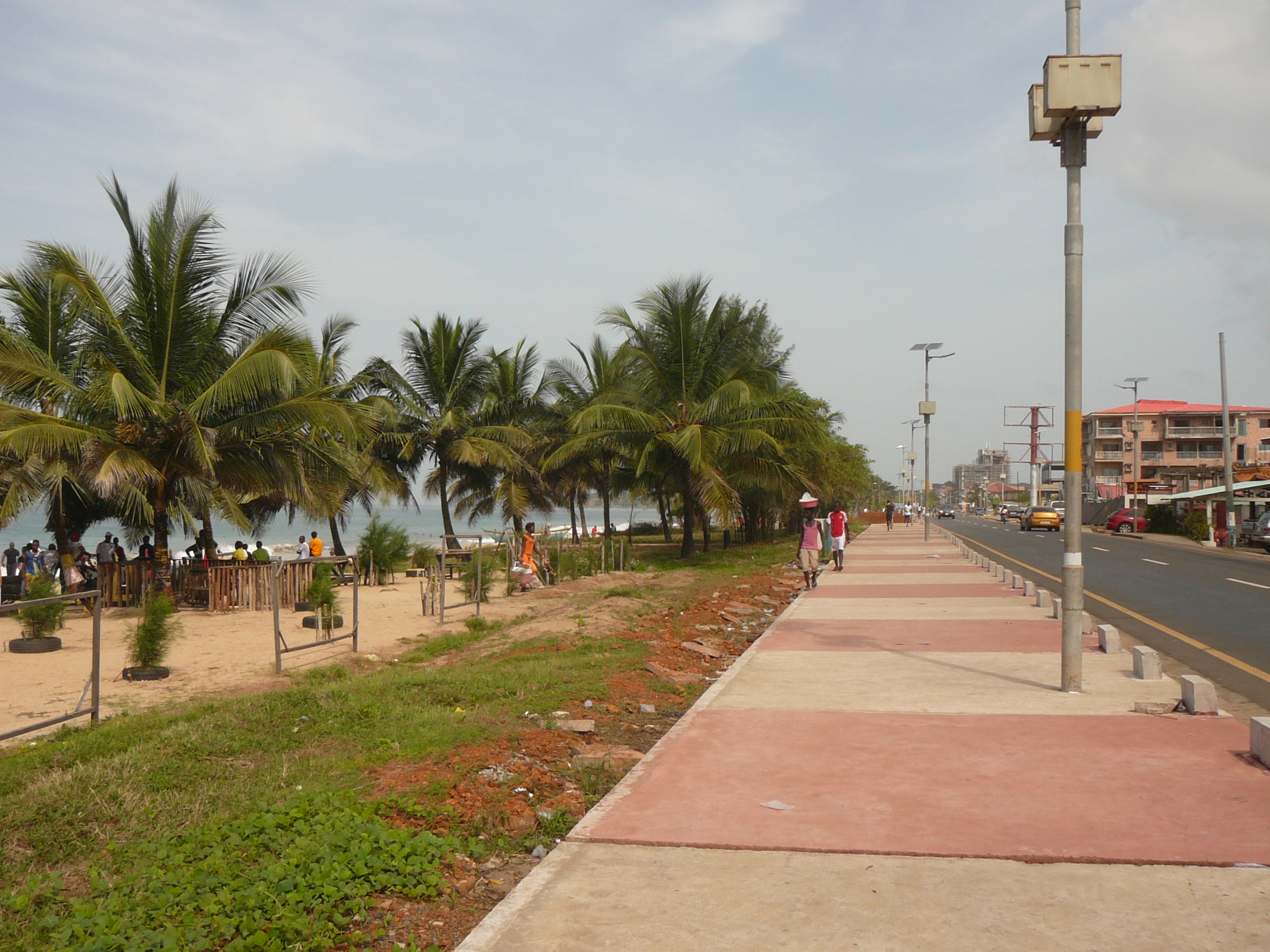
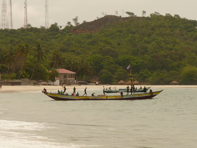
Saturday morning is traditionally the day to clean your house and do the washing, so what better time to head for the beach? We drove down to the ‘town’ beach – Lumley Beach – for a morning walk. We began at the southerly end beside the golf course and headed north. The sky was leaden grey and covering the tops of the hills behind us – an indication of what the rainy season will be like. We hoped this wasn’t an early end to the dry season! However by the time we walked for half an hour and turned for the walk back, the sky was clearing and the sun came through. We had timed it perfectly!

There is no doubt that this is a rapidly developing city, but the proximity of the sea, such a beautiful beach and the forested hills as a backdrop, can give the impression of anything but an urban area of over a million people.

We passed groups of locals, young men in football strips, fishermen hauling in nets and individuals walking or jogging along the sand. No one hassled us, no one tried to sell us anything, in fact no one really took notice of us apart from a few waves and some mumbled greetings.

We had been warned to wear thick-soled shoes, but down on the tide swept hard sand there was no litter, unlike the upper areas of the beach, which in some parts were being swept – outside the beach bars. The beach is on one side of a narrow strip of land between the ocean and an inlet lagoon along which there is a road and some small scale hotels, guest houses, restaurants and shops.

The sea was fairly calm, with the odd break offshore, where there must be a sandbar. However from the sharp angle of the fisherman’s nets, it looked as though there must be a strong current flowing south. In several places teams of seven or eight men were leaning back like well angled tent pegs, feet planted in the sand, pulling on a long rope, the floats of the nets still far out. I liked the look of the rope coiling job which fell to the chap at the back, who therefore had less pulling to do! I did think a pulley with gears would help them.

Further along, three men launched a colourful wooden fishing boat and began paddling kayak style, with rather small looking paddles – they looked the size of conventional oars, but with the ends slightly more diamond-shaped.  They just didn’t look big enough, or enough of them for a largish (4m?) boat on the ocean.

A meeting then took us high up into the hills just above where we live, to probably the best hotel in Freetown, the Country Lodge, although you certainly wouldn’t suspect it was there from the state of the road leading to it! However we bumped and rattled past some amazing old houses, built in colonial times for administrators, sadly now rather run down, but still owned by the government and occupied by civil servants (click on first link to see the houses as they were when built and second link to see them now – towards the bottom of article – along with other historic houses). A former British colonial administration building with a covered stairway looks out over the bay from the Hill Station neighbourhood of Sierra Leone's capital Freetown

Image: thanks to http://www.thisissierraleone.com/freetowns-colourful-wooden-houses-a-symbol-of-sierra-leones-past/

They are built up off the ground on metal and concrete stilts.  A staircase with a corrugated iron roof (essential in the rainy season!) and lattice-work sides leads to the main living quarters on the first floor, and the kitchen is in a separate block – this was a precaution against fire. The main part of the house is wooden planking with numerous windows. Rumour has it that they arrived as flat packs from Harrods! Ikea equivalent nearly a hundred years ago! It must be said that considering the climate, which is particularly hard on wood, they have lasted very well! The houses are perched either side of the apex of the ridge, overlooking the city in both directions, so they catch the breeze as well as having stunning views. The houses were built after research showed the connection between malaria and mosquitoes. It was thought that up here in the hills there would be fewer mosquitoes. The houses are a short (if steep) walk from what was once the top of the 5.5 mile (8.8 kms) mountain railway from downtown to Hill Station, they are shown as the dots on this map ca 1925.

Map of line from Freetown to Hill Station

Map courtesy of http://www.tpo-seapost.org.uk/tpo2/tpsierraleone.html

Country Lodge aspires to be a top class hotel but needs some upgrading to achieve this. However the location ensures a wonderful panorama over Lumley Beach (on the right) and the coast to the south with large tracts of recent development in the valley below and rapidly spreading up the hills.

On our return home, our resident troupe leader visited the balcony:

These are Green Monkeys (Chlorocebus aethiops sabaeus) – unless anyone knows better?