Turtle Islands Odessey

The Turtle Islands lie tantalisingly close to Sherbro Island, but are a world away from mainland Sierra Leone and certainly seem that far when trying to visit.

Having arrived in Bonthe [see previous posts about Bonthe and the journey there], we discussed the trip to the Turtle Islands with the boat driver to determine how long it would actually take, having heard several different estimates. We were assured that if we left early (7am) the tide would be right to reach the islands in about an hour an a half. We would have to wait there an hour or so for the tide to ebb, then we could return in similar time. So we agreed and set our alarm clocks.

P1180852
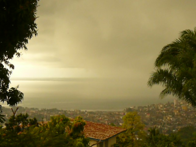
We departed just after dawn broke with the rising sun reflected by the glassy water. Our boat created a white wake as we sped past sleepy settlements on the low lying shoreline. Small groups of houses appeared, preceded by the sight of tall trees above the normal height of the mangroves. In some places we could just see a dark entrance way into the mangroves, wide enough for canoes,  but the settlement remained hidden by the foliage.


After the predicted time, our first view of the islands as they emerged on the horizon.

This is the tiny sand bar known as Nyangei, which is an incredibly high-density settlement on a narrow slither of sand, shown as N on the satellite image below and in close-up. There are over 80 houses on this tiny island. We approached from the north and first tried to go past the west side but were prevented by the emerging football field. We could see the goalposts sitting in the sea off the bottom left corner of the sand, but within half an hour it would be a dry pitch, so we had to retrace our route to avoid being marooned, and passed the other side of the island.

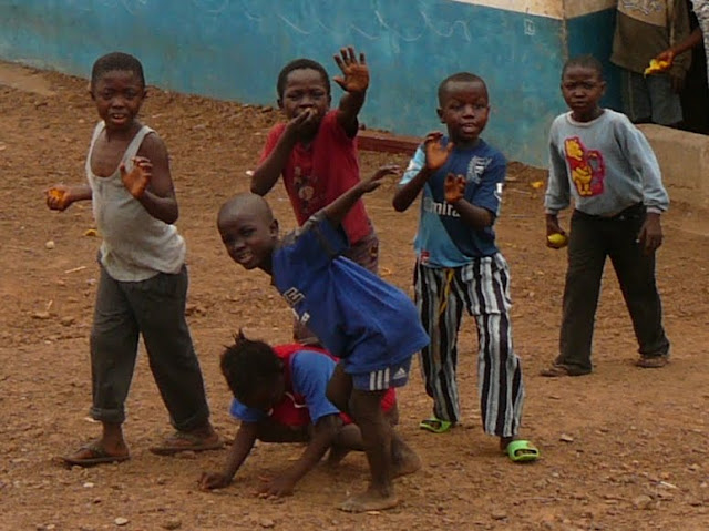
Our first stop was on Bakie – lower centre of the image above [click on it to magnify]. At least half the population came to greet us on the beach and the head man showed the community the cash gift we gave him, before pocketing it for safe keeping. After a refreshing coconut picked for us from a nearby tree, we walked around the island, guided by adults but followed by a posse of children; those with shoes having the advantage, while those without ran from shady spot to shady spot to avoid burning their soles.

P1180865

Almost all the huts were built from natural materials, with a stick frame filled in with mud from the inside and a thatched roof. Dotted around were small, roofed structures with ladders for access by poultry (centre of photo). Further back in the village were smoke-filled huts where the daily catch is preserved before being transporting to the mainland. The art (or science?) of smoking has been lost in some parts of the country and there have been instances of fish rotting when not correctly smoked.

P1180869

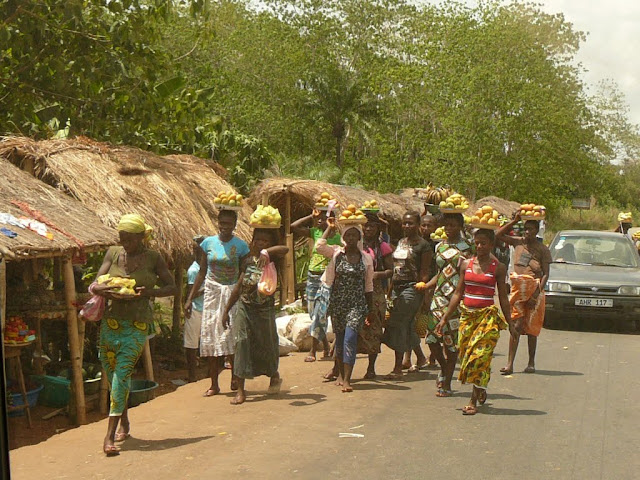
Shell debris littered the whole area showing how important a resource this is – we later saw a large pile of dried cockles, also ready for trading.

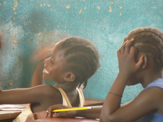
Following the school teacher, we went to see the primary school (photo below) which serves about 100 children; a blackboard on each side so two classes run at once. The older children have to go to Bonthe or the mainland for further schooling. This is a community school not supported by the government.

P1180870

Having finished the village tour we  were shown the Bakie Guest house which is marked on Google Maps and described in the Bradt Guide, but sadly is no longer habitable; the roof was removed by a storm and the building now looks decidedly dilapidated.

We walked from the guest house south along the beach to the end of the sand and unfortunately found ourselves separated from a further beach by a swampy inlet. Later it was passable and the whole coastal stretch around to the Atlantic was available.

It was then time to wait for the tide to flow out, before we could make our return journey, so we sat under a palm tree and relaxed as the villagers went about their business, cooking, playing, hairdressing, mending nets and sitting chatting. On a second pass a long the beach with the vague idea of having a swim, we realised that the stretch of sand just outside the village was in fact also the local toilet, so we passed on quickly and only paddled much further down. The water was not inviting as it shelved slowly and was not well tide washed. It appeared muddy and stirred up easily, so that, and the jelly fish beyond, kept us in the shallows.

P1180866

Once the tide was deemed right, we said our farewells and set sail across the bay to the next island of Yele where we went through the same routine; greeting the head man (with cash), touring the village, visiting the school and being shadowed by dozens of children.

yele

The settlement on Yele was slightly larger than Baki and had more concrete houses, plus a substantial school building (built a few years ago with help from the Bonthe council); the shiny roof at the bottom of the image.

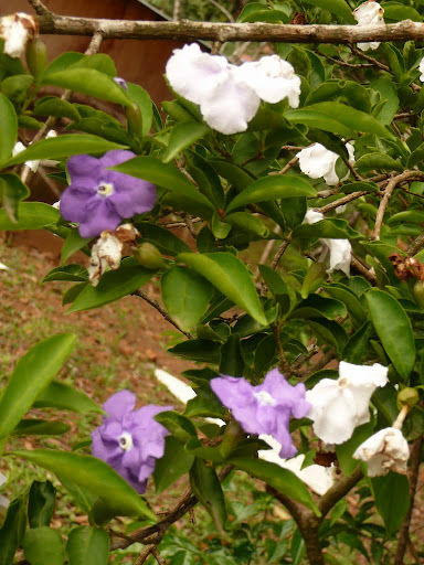
The soil on these islands is mostly sand and very little grows apart from scrubby vegetation, some fruit trees and plenty of mangroves. In the villages a few people had small vegetable patches, fenced to protect them. The villagers seem to rely heavily on the sea to provide what they need and trade with Bonthe and the mainland for what they lack. It is a remote existence, certainly far from the madding crowd. I am sure if you slung your hammock or pitched your tent, you could spend a night under a canopy of stars away from the frenzy of modern life, but we preferred to return to a comfortable bed.

Most of the boats traversing the area between the islands were powered by poles punted through the shallow waters. It was these shallows, which you see a hint of in the satellite images, which slowed our return journey, the boat having to aim for the deeper parts and creep over the shallowest. Once out into the main river, progress was faster, but it took a good deal longer coming back, not helped by having to conserve fuel until another boat could rendez-vous with us to bring further supplies of diesel.

We had made our trip to the Turtle Islands. We didn’t see any turtles, but had not expected to. Several species are seen hereabouts and nest on these southern beaches. The remote location should be reasonable protection for their breeding sites. They are legally protected in these waters, but with little enforcement, whether the ban on killing them or poaching eggs is effective or not, who knows?

Was the trip worth it? On balance, yes, it was interesting to see these remote islands, which seem to float like bubbles from the tip of Sherbro Island, and the people who inhabit them. So long as your expectations are low, you will not be disappointed.

P1180859


Bygone Bonthe

It is tempting to say that arriving in Bonthe is like stepping back in time, there are few motorised vehicles on the island (we saw one working tractor and a couple of motorcycles), so the pace of life is slowed to a stroll. However if we had stepped back in time in Bonthe, a hundred years ago, or even sixty, we would have found a bustling, thriving, trading centre which is far from the reality today. As Thomas Aldridge observed in 1910; “In the stores of the European firms, in the stores of the Creole traders and of the Syrians, outside the stores, on the roadside pitches, hawkers, pedlars, and itinerating hucksters all vie in their respective ways with one another. There is selling over the big counter, over the small counter, off the strap tray, out of calabashes carried on the heads of the little pickins [sic: children] and even from off the ground itself – all is trade, nothing that brings in ‘cash monies’ comes amiss.” The bustle this suggests is long gone. The remains of its heyday litter the waterfront; decaying warehouses, a broken seawall and abandoned houses.

Compare these photographs with those below taken in 1958, by which time the river had silted up and ships were no longer able to anchor off Bonthe or York Island. Instead launches took cargoes of palm kernels, groundnuts and pissava [dried palm stalks used for brush bristles] out to ships tied up 5 miles downstream. But it was still a lively settlement with a resident District Commissioner.

The ruin above centre is the large building seen behind the jetty. The building on the left is the local court. Just behind it is the jail, surrounded, as is customary, with razor wire topped walls, but as we walked around town on our first evening, our guide indicated three men who had just passed us with a friendly greeting and told us they were the prisoners returning to jail. On further questioning he explained that they were let out each morning and they went to work for someone, returning, by themselves, in the evening. He told us that prisoners applied to be transferred to Bonthe jail from the mainland because they know they will be allowed out during the day. The crime of one of the prisoners was to have stolen one of the solar powered street lights – not the most intelligent crime on a small island; we wondered who he thought he might sell it to?? The RUF leader Foday Sankoh was held here while awaiting trial at the UN Special Court following the war; he died before facing justice.

The decline of Bonthe as a trading settlement began with the opening of the railway which ran across the south of the country to Pendembu. Much of the palm kernel trade, which had previously been shipped out of Bonthe, diverted to the railway and the docks of Freetown. The silting of the rivers followed and gradually Bonthe was bypassed.

There are many active churches and mosques in Bonthe and a few in ruins.

St Matthew’s was consecrated in 1900, had taken four years to build and cost £5000 (probably close to £2m in today’s money) – raised locally – and could seat 500 people. The three stained glass windows, which we were able to see whilst the church was being prepared for Palm Sunday, were shipped out from England. One was in memory of those killed in the Hut Tax war of 1898, one for the pastor who began the project but died before it was completed and the third to commemorate Queen Victoria’s Diamond Jubilee. The latter was unveiled by Thomas Aldridge (then District Commissioner) and the pastor’s wife.P1180896

St Patrick’s is in the compound of the school with the same name and had some rivalry with St Joseph’s nearby, particularly on Empire Day, according to Peter Tucker in his autobiography ‘The Mission Boy from Shebar’. The school bands paraded through the streets to the playing fields and back; the crowds followed their favourite band – always St Patrick’s he claims!

The evening we arrived there was a football tournament being played at the playing field to the west of the town. We could hear the excitement from far away. Some supporters found creative ways of not paying the entrance fee.

These pillars were at the base of a huge water tower which used to provide water to the entire town, but is no longer shiny and no longer in use. A little further along the track, just before the airfield is the town cemetery, which we reached as the sun set behind the palms.

One of the tourist sights of the town is the Clock Tower at the end of the main street, Medina Street. Unfortunately, even though the tower is now painted in patriotic colours, it no longer has a clock. The rusted remains of one face languishes inside the tower. The photo taken in 1958 shows the clock in situ. It also shows the palm trees a little shorter and either telephone or electricity wires – which are long gone.

So many of the old houses are looking sadly neglected and unlikely to last much longer, but most are probably a hundred or so years old, so may last a little while yet.

update: 29.04.16: found the following picture of Bonthe dated 1915!

victoria road bonthe 1915

The old Wesleyan Methodist church is also a sad sight, slowly being reclaimed by nature.

Nature is also doing its best to reclaim another of Bonthe’s tourist highlights – the tree in the ship….

P1180781

Long since marooned on the shore, the rusting hulk makes a good plant container.

P1180923 (2)

A local speciality is furniture made from palm stalks, stacked in alternate layers to form boxes. A back is attached to a chair with a slopping stalk.


Some of the people we met around town:

And the lady who insisted that I ‘snap her’ while she drew water from the well:

P1180807

On our second evening the sun set behind the town leaving us to reflect on the calm waters of the lagoon (or ‘swamp’ as Google maps so succinctly puts it).


Sierra Leone – why the name?

Every book, history and website that discusses Sierra Leone has a story to tell about how this country was named. There is no one accepted account which can be fully verified, but I will attempt to include as many as possible and offer my own theory.

While there were undoubtedly people living in the area before anyone passed by in a ship, these people have left only fragmented oral history; they had no means of making written records, much less maps. We therefore rely on reports made by later visitors who recorded what they heard about the names of geographical features.

One such source is a book written in 1803 by Thomas Winterbottom, called ‘An Account of the native Africans in the Neighbourhood of Sierra Leone’, which is fortunately available online. He reports that the local Temne people called the area Romarong which means the Mountain  [marong is mountain and ‘ro’ a common precursor to place names in Temne eg. Ro-baga]. They called the river which meets the sea here, Mitomba – now known as the Sierra Leone River. Another name for the river was Tagrin, which seems to be a name deriving from the Bullom people of the north shore, as the name survives today as the point from which the ferry leaves the north shore, which is also identified by Winterbottom as Tagrin Point. He explains that the northern side of the river is Leopard’s Island , known by the Bullom as ‘Ee-yil-eek-bill’ [ee-yil = island/ eek-bill = leopard] and is at the top edge of his map below. An earlier Portuguese account says the locals call the river and village to north Taguyri, whilst the country to the south and village there is Pymto/Pinto. This also says the mountains have been named Serra Lyoa because they are “even steeper than that of Sintra (in southern Portugal) and ten leagues in circumference” {Valentin Fernandes: Description de la Cote Occidentale d’Afrique 1510}.  A simple explanation which, maybe others thought, needed a bit more elaboration?

winterbottom map 1802A

Winterbottom quotes Cada Mostos’s account of Pedro di Sinta’s voyage [1462] that they called the cape on the southern side of the estuary, Cap Liedo/Ledo ‘on account of the gay appearance that and the country afforded them’. At the other end of the range of mountains they found three islands (Banana Islands) which “they called Salvezze and the mountains Sierra Leona, on account of the thunder upon the summit of it, which is continually wrapped up in clouds and mist”.  This must have been during the rainy season, most likely July-September. Winterbottom also observes that the hills viewed from the Bullom shore appear ‘heaped upon each other in a very irregular manner’.

gun fireThis footnote on page 16 refers to the mountains which face the Sierra Leone river, but are essentially the same chain which is the backbone of the peninsula, and suggest the Portugese called these “Montes claros” or ‘Clear Mountains’ because of the loud echo they returned from gunfire and thunder [although the connection eludes me].

An account dated 1841, by the Rev Samuel Abraham Walker, claims Sierra Leone means ‘Lioness Mountain’ and that most interpreters say it is because ‘the area was found to abound in lions’, but follows this with a quote from Winterbottom, denying that lions are, or ever were, found in the area. Rev Walker also suggests the name might derive from the noise of the surf on the shore being lion-like [although other commentators have said that the surf on this shore is not particularly noisy.]; his source being Hardouin’s notes on Pliny [translated in 1680s].

This made me curious. Why was Pliny [born 23 CE] writing about Sierra Leone? In his fifth book on the History of Nature he describes what is known of Africa. He reports the voyage of Hanno of Carthage in 5th or 6th BCE. Modern interpretations of this voyage think it reached as far as Gabon, passing the west coast with the following descriptions, others speculate it only reached Sierra Leone.

hanno

Mountain Barce is thought to be the the Dakar peninsula in Senegal. The River Bambotus could be either the Sierra Leone or Sherbro according to some interpretations as both have fresh water at the mouth suitable for both crocodiles and hippos, whereas the River Gambia (another candidate) is salty. There is much scholarly discussion about how far Hanno actually sailed. Pliny is writing from a single surviving copy of the voyage report and the original may have been written deliberately vaguely or even misleading in order to confuse competitors. Unfortunately, I cannot find the surf reference quoted by Rev Walker, which he appears to have read in a different publication.

It is generally accepted that the name Sierra Leone derives in some way from Portuguese, but whether the name can be attributed to one individual is disputed, as cogently argued by C Magbaily Fyle. Many voyages were made by the Portuguese along this coast from 1446, each captain of which would have made his own charts and likely kept them secret to prevent others exploiting the knowledge. That the name Serra Lyoa or a variation thereof [Sierra/serra liona/leona/leoja/leola/leoa/leao] appeared on such maps is confirmed by the use of the term after Pedro di Sinta’s voyage. milton

The name was certainly used, and the reputation for stormy weather was known, in the 17th century as Milton refers to both in the poem Paradise Lost, published in 1667; referring to the southern wind [Notus] and ‘thundrous clouds from Serraliona’.

Although the naming of Sierra Leone is accorded to the Portuguese and later the British who formalised the name, it is the French [Normans] who can claim to have been the first Europeans in modern times to navigate these shores. A contemporary account of the voyages of discovery sponsored by Prince Henry the Navigator in the 15th century, reports the exploration, trading and settlement  along the coast by sailors from Dieppe in the 14th century. Kaye Centers examines the evidence for these claims in her thesis, but sits on the fence, saying there is some evidence to support such claims, but not enough to be conclusive. The Normans claim to have settled at the places on this map: Petit Dieppe, Petit Paris, Assini, La Mina, Akra

map of french WA voyage

However they appear to have sailed past Sierra Leone without landing.

One suggestion for the name Serra [saw] leone is that the mountains look like lion’s teeth. But I think this unlikely:

It would take a great deal of imagination to construe these mountains as lion’s teeth, unless a very old lion with worn out molars.

However, another theory put forward by Kamara  and others for the reason behind the naming of Sierra Leone, is that the shape of the mountains from out at sea look like a lion and this combined with the sounds of thunder were the source of the name.  I feel that this is more likely:lions

  1. Head 2. Rump of recumbent lions

Sailors approaching land are likely to ‘see’ shapes in outline and these are at least as good as other ‘Lion Mountains’ around the world, for example Lion Head, Cape Town, which I could never quite make out.

P1130007 (2)

Lion Head, Cape Town

Or Lion Rock, Hong Kong.

So although I cannot point to strong historical evidence for this theory, I can show why it has credence. Perhaps the roaring was added to give more authenticity and colour to the tale.

I have found no source showing that lions were ever found here. Leopards are certainly mentioned and as forest dwelling animals are more likely. All early descriptions of the country say it was forested, which as far as I’m aware is not the natural habitat of lions. Whatever the reason for the original name, it has stuck and the lion has been adopted for the coat of arms of the country. If you have any other theories to share, please leave a comment.

Coat of arms

300px-Coat_of_arms_of_Sierra_Leone.svg


Update: I just came across another supporter of the lioness shape theory; non other than the polyglot explorer Richard Burton who visited Sierra Leone in 1882 and reported the following:

“The reason is disputed; some invoke the presence of the Queen of the Cats, others the leonine rumbling of the re-echoed thunder. The latter suggested the Montes Claros of the Portuguese. Cà da Mosto in 1505 tells us that the explorers ’gave the name of Sierra Leone to the mountain on account of the roaring of thunder heard from the top, which is always buried in clouds.’ But the traveller, entering the roadstead, may see in the outline of Leicester Cone a fashion of maneless lion or lioness couchant with averted head, the dexter paw protruding in the shape of a ground-bulge and the contour of the back and crupper tapering off north-eastwards. At any rate, it is as fair a resemblance as the French lion of Bastia and the British lion of ’Gib.’ Meanwhile those marvellous beings the ’mammies’ call ’the city’ ’Sillyown,’ and the pretty, naughty mulatto lady married to the Missing Link termed it ’Sa Leone.’ I shall therefore cleave to the latter, despite ’Mammy Gumbo’s’ box inscribed ’Sa leone.’”


Kent, Western Peninsula, Sierra Leone

The usual reason to visit Kent is to catch a boat to the Banana Islands, about half an hour away, but we decided to have a look around the village’s historic sites.

P1180548

Our first impression of the village was not the best as we parked beside an earthen football pitch, strewn with plastic debris. Some men loitering nearby became a little belligerent when we said we just wanted to walk around the village, but later were more amenable and offered to show us around.

Boats are launched from both sides of a sandy isthmus which joins the village to a rocky outcrop. Fishermen were busy mending their nets. The Banana Islands floated hazily on the distant horizon.

From the fishing port, a sweep of pristine sand curves towards the hills. This beautiful beach was deserted. The lack of facilities and lack of any road direct to the beach must deter visitors, although there are a couple of resorts at the far end. The superstitious might be put off by the presence of a graveyard just behind the beach. A beautiful location to be laid to rest, marred slightly by the ubiquitous plastic debris blowing around behind the beach. Men were clearing the beach, but seemed to dump their collection behind the sand.

Between the village and the fishing port is the remains of the old slave baracoon, marked by a laterite wall, in places being absorbed back to nature. In the middle is the current primary school built directly on what was the holding pen for slaves – now only visible through small slits which allowed a minimum of fresh air into the space (the black section of the wall). The small door was barred and locked, but it was obvious that the height of the inner chamber was less than an adult would need to stand. The quarters above, now replaced, were used by the slave traders.

Back in the village we were shown other remains of old buildings used by slave traders, who collected slaves from the interior here, before transferring them to the Banana Islands or other trading points such as Bunce Island where they would be loaded on ocean going vessels to cross the Atlantic.

Down a track, to another part of the shore we found an abandoned sea-pool and derelict house. This was the seaside home of Siaka Stevens, former president.

The Stevens family still owns the site and a building next door, which was at one time a library, but is being renovated as a private house.

The church service was in full swing as we passed by and the two policemen on duty at the old colonial police station were busy doing their washing.

So, having thanked our guide we left Kent content that we had seen the historic sites. We returned past Burreh beach to the less visited John Obey. Here at Tribewanted, we ordered lunch then walked the length of the approximately 2km pristine beach, which is backed by a large lagoon preventing access from the peninsula road. At the far end of the beach a private dwelling has the only other access to the road.

Tribewanted aims to develop sustainable tourism in cooperation with local communities. Guests stay and get involved in building the sustainable infrastructure. Here at John Obey, one of the projects was the adobe houses inspired by CalEarth made from local materials and designed to have natural air conditioning with intakes low down on the walls and outlets high up (using the principle of warm air rising).

P1180574

We went into the larger dome (not pictured) and found, in the middle of the day, it was indeed cool inside. There are also two wooden huts for rent, with bucket showers. The toilets on site are composting in line with the sustainable ethos.

Our lunch of grilled fish, chipped sweet potato and papaya was served overlooking the sea at a shady table. Nearby hammocks swayed in the breeze. It’s certainly a peaceful spot in which to chill for a few hours or indeed to stay overnight.

P1180592


Bunce Island: abandoned slave fort

One Saturday we took a slow boat, not to China, but to Bunce Island, a former slave fort, in the estuary of the Sierra Leone River. We passed the island before on our way down river from Marampa mine, but this time we landed and explored. Briefed already by the exhibition at the National Museum and meeting representatives from the Bunce Island Coalition, we were prepared for the tour. We also had a guide on hand to explain what we were seeing. The hills behind Freetown were misty as we chugged up river. We first clung to the shoreline, which is actually the main shipping lane, past the port, before crossing the main body of water and passing the ferry terminal on the Lungi shore.

Thus we followed the route of the slave ships arriving from Europe. They would have been attracted to the river entrance by bonfires lit on Cape P1110720 Sierra, the promontory which extends furthest west into the Atlantic. Pilots would have boarded the vessels to guide them past the shallow banks in the middle of the river. On our return journey it was low tide and we saw for ourselves how extensive the sandbanks are. Many fishermen had beached their boats on them and were filling sacks – presumably with shellfish.

On the north shore the land has little elevation and little population, so it is tree-lined and green, with a sandy fringe. The sky had cleared and the sun shone brightly on the small boats on the water, including three with sails. There is no jetty on the island, so the boat pulled in to the beach as far as it could, leaving us to step into the water and paddle ashore. We landed besides the remains of a concrete jetty constructed during WWII, but no longer in use, and close to the stone ramp which used to lead up the slope to the fort and down which the slaves took their last walk on African soil. An old cannon with the insignia of King George III lies abandoned on the slope, pointing out to sea.

P1110803The trees beside the landing area have names carved into their bark, but these are not the last legacy of slaves – the trees have grown since the fort was abandoned in the mid 19th century. Looking up from the beach the walls of the former fort loom between the trees which now dominate the skyline. In the era of the fort this area would have been clear of vegetation to give the slavers clear view down river, so they could see both approaching slave ships and pirates or enemies. The fort was attacked by the French four times, and by pirates twice. It was burnt to the ground several times, but was so lucrative that it was rebuilt to carry on the trade. Behind the main wall facing the sea are a line of cannons, but these were insufficient to defend the fort. They were used to salute vessels and as a volley to delay attackers while the traders escaped from the back of the island, upriver until things had quietened down. The island was at the limits of navigability for ocean going vessels.

P1110727

The old entrance to the fort

It was essentially a trading post.The Europeans traded goods for the captured slaves.  The island was rented from the king of the Bulom (north) shore, Bai Sama, who received annual rent in trade goods (guns, cloth, axes, knives, alcoholic spirits, clay pipes, beads) and married his daughters to the traders to act as spies. He also supplied workers for the fort and neighbouring shipyard. Some 600 free Africans worked on the island or adjacent Tasso Island on which they grew food for the fort and from which fresh water was transported.

Slavery was a trade which had criss crossed West Africa for centuries; raids and skirmishes between tribes resulted in the taking of slaves. These were then traded with other tribes, or itinerant traders and could end up far from their home.  The tales of Olaudah Equiano tell of his abduction as a child in the Niger Delta region of Nigeria and subsequent travels across West Africa as he was traded and passed on until he finally took ‘the Middle Passage’ and reached the West Indies. He later settled in Britain and wrote his memoirs to help the abolition movement. A good description of both the trading along the coast and the Middle Passage is found in Sacred Hunger by Barry Unsworth.

The slaves gathered on Bunce Island were treated as commodities, transported in appalling conditions and sold to work on plantations in the New World. The triangular trade between Europe, Africa and the New World made many fortunes and transported thousands of Africans far from their homes. A community in South Carolina, the Gullahs, can directly trace their DNA to Sierra Leone and some have visited Bunce Island in homage to their ancestors.

P1110737

Cannons with the insignia GRIII abandoned beside the defensive wall

P1110743

Inside the ruins of the main building

We walked up to the old fort entrance where we found a well, now almost surrounded by the roots of a giant tree. No safety barrier protects visitors from the sheer drop of about 10 metres to the level of the water. We walked up the slope into what would have the ‘the front yard’. This would have been clear of vegetation and the cannons would have been mounted on wooden carriages ready for action, in front of the main building which was two storeys. A covered verandah would have surrounded the upper level, and from here the traders could survey the water to the front and the slave yard to the rear. This balcony is long gone.

In places the walls are seemingly being consumed by the vegetation – somewhat reminiscent of Ta Prohm in Cambodia.P1110750 The ruined walls show that some local stone was used , but much of the interior walls of the main building are of brick, brought as ballast in ships arriving from UK. They would have also brought the goods for trade which were unloaded and sorted next to the main building. Once they had loaded sufficient slaves, fresh water and provisions, they would set sail for the New World.

We walked around the ruins, through the male slave yard and the smaller yard behind, which was for the women and children. Little remains but the crumbling outer walls. Stepping down levels towards the rear beach we passed the former strong room, now almost enclosed by the protective curtain wall of a tree root. There was a separate store for explosives, well away from other buildings.

P1110775 P1110761 Our circular walk brought us back to the entrance, from which we headed south along a quite wide track through the most amazing cobweb strewn palm trees. They would be perfect for a tropical version of Miss Haversham’s house. At the far end was the island cemetery. A few headstones survive, some elaborately inscribed, others just rough rocks. It was very peaceful. The cemetery extended much farther, but is now overgrown. The only grave bearing an African name has become a place of annual pilgrimage for his descendants – unfortunately they are in the habit of breaking off a piece of his gravestone to take with them, so it is a shrinking relic.

Bunce Island is now so tranquil, the trees so beautiful, that it is hard to conjure up the disturbing past. It was an interesting day out, but the difficulty reaching the island (you need to rent a boat) means that it is unlikely to become a thriving tourist spot. That is probably not a bad thing – the ruins can remain, as silent witness to what happened here.

The tranquil cemetery area

The tranquil cemetery area

Our return journey was hampered by the incoming tide which whipped up a few more waves than our flat boat was happy with – several broke over the bows giving us a refreshing free ‘surf look’. Once again we crossed the width of the river and kept to the shore – this time looking for some sheltered water! The bonus was a close up view of the old Fourah Bay College building , founded in 1827 by the Church Missionary Society, in the foreground and the more modern one on the hill behind.

P1110817 (2)

The ruins of the original Fourah Bay College on the right and the modern one on the hill behind (left)

En route back to Aberdeen we passed King Tom bay and saw a marooned boat, apparently washed there by a hurricane.

P1110848

Changes afoot

For those of you waiting anxiously for a blog update, I am going to post a few photos to keep you going, while I bask in the glorious UK summer.

This little creature appeared on the patio just before I left- I think it would be happier in a tree. There are, apparently 160 species of chameleon, many of them native to West Africa, and I haven’t yet found which this is. Nothing on Google images to help, so if anyone has any suggestions, please leave a comment.

P1100257

I was somehow reminded of ‘Jungle Book’ when three palm nut vultures took up a perch each.

P1100140

I did see one snake in the garden – didn’t have my camera to hand, and in any case jumped too high to take a decent photo. It had yellow and brown/black longitudinal stripes about 0.5m long – any ideas folks?  The gardeners seem to call every snake ‘mamba’ so they didn’t help.

Next post will be some flower photos, so get ready for ‘what’s this flower’!


Fresh air, flowers and football

Back in Freetown the rains have begun and the landscape is transformed. Our lawn is green and the leaves are gleaming, washed of dust by the downpours. The colourful bougainvillea has been joined by fragrant gardenia, frangipani and a bush the gardeners call the yesterday-today-and-tomorrow plant: it has both white and purple flowers on one plant, which come and go in a matter of days. I have now discovered, thanks to the link shown, that the first day the flower is dark purple, the second lavender and the third it turns white before dropping off. That is quite an amazing biological change!

When it isn’t raining, the air has a crisper quality and the far shore is more visible. Our view has also been improved to the left, as a neighbour has followed our lead and been tree trimming. We can now see the giant scoreboard in the National Stadium – where there is a game going on between Sierra Leone and Tunisia.  A huge roar went up when the home side scored and a more muted sound when the equaliser came.  The smoke in the background is from the part of the city where rubbish is constantly burned.

Last weekend a sudden storm blew up from over the hill:

First the clouds gathered, then came the wind whipping the trees and scattering leaves, and soon after down came the rain:

It’s dramatic and good to watch from the safety of a waterproof house, but plenty of local houses are not so fortunate.

The rains seem to have brought an influx of  bird life into the garden, so I keep my book (Birds of Africa, south of the Sahara) near at hand, but usually need to take a photo to have time to trawl through all the possibilities.  Thanks to my Facebook friends I have identified this one as a black-necked warbler (very similar to the spectacled warbler of East Africa – a slightly different beak being the difference):

While keeping an eye on the wildlife, I will be photographing the flowers in the garden next – treading with caution, as the rains bring out the snakes!  Maybe I’ll be able to get a picture of one to share!

Growing the future

Much education today is monumentally ineffective. All too often we are giving young people cut flowers when we should be teaching them to grow their own plants.

John W. Gardner


There is more to Sierra Leone than Freetown and the peninsula beaches. My first journey ‘up country’ was to a small village near Port Loko – three hours drive each way. A group of ladies from the International Women’s Club (IWC) gathered early one morning, ready to pile into the project’s Landcruiser and set off. We had been invited by one of our members, Ann Beatty, who is a volunteer with Educaid and keen for us to see the work they are doing.

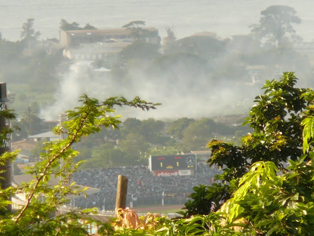
We have all made the journey down the hill to the centre of town many times, but for some of us this was the first time into the eastern side of the city, where the one road is choked with traffic, mingling with hand carts piled high with goods, being dodged by pedestrians and okadas. Despite our early departure, we were not quite early enough to avoid the jams. It took over an hour to negotiate the sprawl of Freetown. We were then released on to the open road and the joyful surprise that it is smooth and easy driving!  Of course, not completely relaxing as there are lorries with varying acceleration, taxis which continue to stop without notice and vehicles of dubious roadworthiness, as well as long distances buses which hurtle along at break-neck speed.

We passed through the busy town of Waterloo (named after the famous battle by some settlers from a regiment which fought there) where the road is lined with stalls selling all manner of goods. The road branches off here to follow the eastern side of the hills which form the peninsula and gives access to the southern beaches – it completes the circuit of the road leaving the western side of the city.

After Freetown, the landscape opened out, with the wide vista over the river estuary to our left, while the hills rose to the right, then the scenery became flatter. We crossed a low line of hills and were then beyond sight of the peninsula. The road passes through numerous village settlements with different styles of buildings, many concrete, some using local materials. The specialty of one village was clear from the roadside stalls selling colourful baskets (it demanded a stop on our return: I couldn’t resist the chance to buy baskets for my fruit and vegetable shopping – to avoid the ubiquitous, flimsy plastic bags).

At one point the road is choked by a single lane bridge and locals on both sides have taken the opportunity to set up stalls selling fruit and vegetables. On our return journey we stocked up on fruit and nuts at cheaper prices than are available in Freetown.

We took a brief tour around Port Loko, where shiny solar-powered street lights had recently been installed, before taking to the more ‘normal’ (read ‘unsurfaced, bumpy’) local roads to the village of Maronka. The access road we used is only passable in the dry season as the wet weather washes away the small bridge crossing the stream (currently a trickle). The alternative route adds another 5 miles to the journey.

Educaid was founded by Miriam Mason-Sesay, who was awarded an MBE in the UK’s New Year’s honours and more recently here in Sierra Leone, the Order of Rokel, presented at State House by the President, in recognition of her efforts to provide quality education in Sierra Leone. As we drove along these rural roads with windows wide open, we heard the cry of ‘Miriam’ from everyone we passed – white women driving; must be Miriam! One okada rider began ‘Miriam!’ then ‘Not Miriam!’

In Maronka, Educaid have built a girl’s safe house and a primary school. Girls from abused and vulnerable backgrounds come to live here from a wide surrounding area. They live together in the safe house and attend the school. Although supervised by staff, the older children look after the younger ones, forming small ‘family’ groups,  and help each other with tasks such as washing their own clothes. The boys are currently billeted around the small village beside the school, but a new house is being built to accommodate them together. There is now a need to extend the girl’s house as it is becoming overcrowded. The girls are also taught vocational skills like dressmaking and have started making skirts on sale via their own label ‘Mariama’ in UK at http://www.houseofbeth.com/collections/beths-shop.

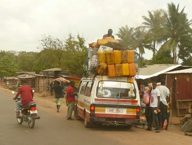
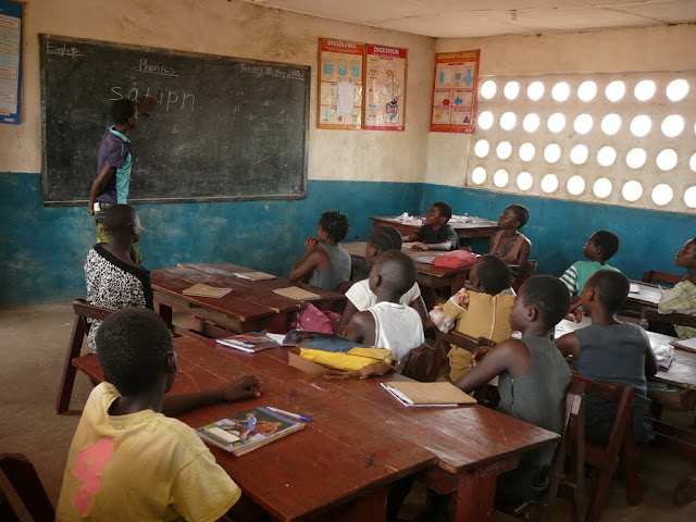
School was in session, so we peered in through the open shutters. Those of us who have seen other West African schools, could immediately see the difference in the ethos here:  the class sizes were much smaller, the desks were not in rows facing forwards, the atmosphere was calm, the children were (mostly) smiling and they were interacting with the teachers, not just chanting and repeating answers. The class clapped correct answers. And most importantly the teachers did not wield a stick! The other surprise was how young many of the teachers are, including the 20 year old Headteacher!

The Headteacher also doubled as director of a play the older pupils enacted for us on the subject of child trafficking; a man goes to a village offering to take two children to his home to educate and help them. However the children are treated as slaves and not sent to school. The intervention of the Family Support Unit who arrest the adults concerned ended the piece. This scenario is all too common throughout West Africa – poor parents are duped into letting their children go ‘to a better life’ by unscrupulous people who then treat those children badly, either in their own country or abroad. They have performed for local villages and won a drama competition in Port Loko.

All schooling is provided free of charge and a ‘no uniform’ policy ensures no one is excluded because of cost. Around 50% of the children live-in and these costs are met by Educaid as well. The largest part of the budget is spent on teacher salaries. Educaid have been training teachers to deliver more child-centred learning, encouraging children to be part of the process and to ask questions. The method is paying dividends. The two secondary schools which Educaid run came 1st and 2nd in last year’s leaving certificate exams. Hundreds of pupils have gone on to tertiary education in Sierra Leone and 6 have gone overseas on scholarships. Not only have Educaid trained teachers for their own schools, but teachers from local schools have also benefited from training and the local education minister is now squarely behind the efforts to improve local education using these methods. There are requests from teachers much further afield and Educaid would like to be able to extend their programme to include as many as possible.

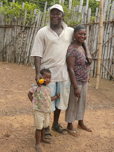
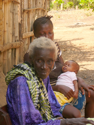
Beyond the classrooms, we explored the village, meeting the chief, his wife, grandchild and elderly mother. He is chief of a number of surrounding villages and has been very keen to support the project. In between the buildings and compounds there were goats, chickens, dogs and ducks wandering at will.  The trees were literally dripping with succulent mangoes! Cashews were there to be picked and not far away palms for oil grow, bananas and papaya too. There must be worse places to live!

After a delicious communal lunch, we presented the school with a large bag of rice and a bag of supplies for each pupil, before we took our leave for the return journey. We stopped briefly at the secondary school at Rolal, where we also received a warm welcome. We all felt enthused by such a positive project with proven outcomes. There is so much which needs to be improved in Sierra Leone, but much stems from education. This project does not rely on fancy buildings or expensive equipment, but on the fundamentals of changing teacher behaviour and changing the method of delivering education.

This entry has a postscript:  I was walking on Lumley beach with some ladies, including Ann on Thursday morning when a young girl selling limes approached us. She asked if she could tell me her story. She told me her name was Susan and that her father and mother were both dead and she lived with her ‘aunty’ (this is a term used for any adult female – not necessarily a relative) who was supposed to take care of her, but refused to pay her school fees and made her go out to sell limes. She also said she was not fed properly. Her clothes were ragged. Ann suggested she take herself to the Educaid school in Lumley where she could go to school for free and gave her the address. We hope she will take up the offer

PS: I am away from Freetown for a few weeks, so will not be adding any posts for a while.  Back soon!

Flight of Delphine Reynolds and W G Pudney

I like a challenge, but early aviators certainly relished an entirely different level of challenge, facing the elements, unknown territory and the mechanical reliability of early aircraft.  So having found out and briefly described one epic flight in my blog ‘Museum of masks and mysteries’, I delved deeper and here publish what I managed to piece together. So although this isn’t entirely about Sierra Leone, it illustrates the isolation of this British Colony and Protectorate, before modern communications.

Sir James Reynolds was a senior partner in Reynolds and Gibson, a firm of Liverpool cotton brokers, before commanding 1/3rd West Lancashire Brigade, Royal Field Artillery (Territorial Force) in WWI (awarded a DSO) and becoming a Conservative MP in 1929. Presumably during his trading days, he had visited the west coast of Africa and ‘and saw its immense possibilities’, so he sponsored a flight via the west coast to Cape Town.  The aircraft was his daughter’s Blackburn ” Bluebird ” (fitted with D.H. Gipsy III 105 horsepower engine) and the two pilots were his daughter Miss Delphine Reynolds and Flight Lieutenant W G Pudney, described in Flight magazine as being an instructor in the National Flying Services. A newspaper report suggest that the the plane had a Gipsy III 120 hp air cooled engine with a cruising speed of 100 miles per hour and a range of about 700 miles.

The original flight plan, sent to South Africa for permission, showed R B Waters (then proprietor of the Gatwick aerodrome) as the second pilot, and stated ‘They would have fire-arms and ammunition in their possession but no radio equipment. ‘ This flight was to have left in December 1930 arriving in Cape Town on 10 January 1931, but did not take place. A follow-up telegram said W G Pudney would pilot instead of Waters and estimated arrival 11 March 1931.

Delphine Reynolds and W G Pudney finally took off from Hanworth on 1 March 1931. A tantalising paragraph in the British Film Institute website suggests there may be footage of this event:

“Miss Delphine Reynolds, whose goal will also be Cape Town, hopes to open up air-mail service between London and the West Coast of Africa” . Delphine Reynolds, in flying apparel, with a male aviator standing in front of her bi-plane numbered G-AAVG. She puts on her flying hat and goggles and gets into the cockpit where she is joined by her co-pilot. The aeroplane taxis along a runway and takes off (93ft).

However the aircraft quoted G-AAVG was not Delphine’s, so I don’t know if this is an error in the description or footage of another take-off. She is registered as owing G-ABGF, but both are the same type of plane.

The weather seemed against them from the start, forcing them to land 20 miles north of Bordeaux then having to turn back on the next leg to Toulouse due to bad weather, which also affected them from Alicante to Malaga on March 9.  We should remember that they were flying at much lower altitudes than modern planes, and were therefore far more vulnerable to local weather conditions.

They were waved off at daybreak on 11 March from Tangiers by the British residents  who gave them a bunch of English heather.  They were also given a letter by the Head tribesman “addressed to any Moorish State, in the event of a forced landing in the Spanish Rio de Ora, to the effect that if care was taken to hand us over intact a suitable ransom would be paid to the tribe responsible for carrying this out.” I wonder how effective this letter would have been since when they arrived in the Spanish penal settlement of Cape Juby,  W G Pudney reports “Everyone was astounded to find a lady in the machine. They pointed out that in the event of a forced landing her chances of returning to civilisation were practically nil. My chances were definitely worse as I should have been murdered. “

Even the airfields, such as they were, could be a challenge: they had great difficulty in taking off from Dakar as heavy rain the night before had made the ground soft.  Other hazards were also evident: “The aerodrome at Dakar is situated six kilometres from the town and overgrown by mangos and ant hills in various places.”

They arrived in Bathurst, The Gambia, on 17 March and here the plane was transformed into a seaplane by fitting floats, which had been sent ahead by ship: “when the crate was opened we were surprised to find a huge black mamba. The crate was dropped by the natives who ran in all directions. The floats were fitted to the machine by myself working in the mornings and late evenings.”  No mention of whether Delphine helped, or what else she might have been doing.

“The machine was launched and a christening ceremony performed by the Governor.” They then flew the length of the Gambia river to Basse and French Senegal beyond, but the river was not safe for landing beyond Basse. While spending the night at McCarthy Island  came the mishap – a local boat, the pilot of which was asleep, collided with the moored plane – which damaged the tail plane, elevator and aileron, but after repair with some copper wire the exploration flights continued until they could collect the new parts back at Bathurst. The report says the flight from McCarthy Island to Basse took 3hrs 15 mins, compared to the 24 hours needed by river boat which sailed once a week, but, looking at the distances below, I wonder if it really means from Bathurst to Basse.

A Bathurst  B Basse  C McCarthy Island

On 2 April they flew the round trip to Dakar with the mail, taking 1 hr 30 mins on the outward journey but only 1 hr 5 mins on the way back (which indicates that Bathurst to Basse would be more likely for a 3 hr flight). It seems as though the French already had air mail services along the coast. The next day they flew to Boloma in Guinea Bissau, where they surveyed the area and reported an “aerodrome was being prepared, one kilometre square.” They flew on to Freetown arriving on 4 April in very rough weather and only found shelter in Kingtown bay.  This seemed the only favourable spot apart from further up the river at Loko (a long way from Freetown), or Pepal (on the northern shore of the river) where the mining company was exporting ore (still doing so today – at night the best lit spot for miles around).

On flights further south they found many suitable estuaries for landing.

At the end of his lecture about the flight, W G Pudney made some recommendations for the future: metal used in seaplanes should be either stainless steel or coated with cadnium as all other metals had been badly corroded by the river water which contained an acidic substance. Seaplanes would need to be maneuverable “so as to avoid moving sandbanks and currents, or floating debris.” Hazards included petrol evaporation (3 in 19 gallons – so important to check your tanks if filled the night before!), weather (sea fogs, sandstorms and tornados), the glare of the sun off flat water, malaria, and the tropical heat: “three minutes in the sun without a topee is the equivalent to a hit on the head with a 20-lb. hammer”. And gave a valuable piece of advice “Before taking off in a seaplane on rivers, first taxi half a mile to disturb the water, and crocodiles and hippopotami will disappear and prevent one running your float down. “

Flight magazine suggested that the plane suffered damage taking off in choppy conditions, but W G Pudney says corrosion made the plane unairworthy, and this is confirmed by the register of civil aviation which shows:

G-ABGF Blackburn L.1C Bluebird IV SB.252 G-ABGF Miss Delphine Reynolds/Gatwick & Cowes 07.11.30 2896 Dbr due corrosion Sierra Leone 5.31

Whatever the cause, it seems this adventure went no further.  Presumably the two pilots returned to UK by ship, but what became of the plane is not known.

The narrative above is mostly taken from a lecture given by Fl Lt W G Pudney to the Royal Aeronautical Society on Thursday, October 20, 1932, in the Lecture Hall of the Royal Society of Arts.

W G Pudney was born in Wellington, New Zealand, leaving with the Third Reinforcements in 1914. He was wounded at Gallipoli and invalided to England where he later joined the Royal Flying Corps and was in combat over the trenches. He continued as a pilot both in commercial exploits and joined the nascent RAF. Some years after returning  to the UK from the flight I have been describing, W G Pudney joined the Railway Air Services Ltd, flying between Glasgow and London. In 1937 he returned to Freetown to join Elder Colonial Airways Ltd and began air services between Freetown and Bathurst. [information about W G Pudney thanks to this site]

Delphine Reynolds

Delphine Reynolds

And what of Miss Delphine Reynolds?  Pudney affords her only one brief mention (a lady in the machine) until the closing remarks acknowledging her father as sponsor and their “keeness in aviation” [sic]. How fascinating it would be to find her diaries or memoirs! This was no easy afternoon jaunt, but must have been gruelling at times, with the heat, dust and long distances covered.  It doesn’t seem to have put her off flying, as she went on to own at least two further airplanes, shown below, but no further information about this intrepid aviator seems to be available. This seems to be a book waiting to be written.

G-ABMJ Robinson Redwing 2 4 G-ABMJ EI-ABC Redwing Aircraft Co Ltd /Croydon >The Scarborough AC>Redwing Aircraft Co Ltd >Miss D Reynolds/Gatwick >Miss R Norman /Heston 22.05.31 3179 Sold Ireland 12.34
G-ACKY DH.85 Leopard Moth 7016 G-ACKY VH-ADV VH-RSL VH-BAH Miss D Reynolds /Gatwick >GM Tonge /Croydon 00.10.33 4472 Sold Australia 12.37

Museum of masks and mysteries

Museums attract me like magnets, even when I know I should have low expectations, I always hope to find something of interest on display.  The National Museum of Sierra Leone did not disappoint (click here to read the history of the museum).

It is as central as you can get in Freetown, right next to the famous, ancient Cotton Tree, which is the heart of the nation. In fact, the smaller of the two museum buildings is the old Cotton Tree Station of the Hill Railway. The windows on all sides of the room allowed cool breezes to pass through keeping the interior at a pleasant temperature without air-conditioning.

This appears to be the original station building very close to base of tree.

This new station building  – no date –  is the other side of the tree and later became the telephone exchange, but is now the National Musuem

photo courtesy of http://www.sierra-leone.org/Gspostcards-9.html

It is said that the on arrival in 1792, the ‘Nova Scotians’ ( freed American slaves who had fought for Britain in the Revolutionary War – under promise of being returned to Africa – and afterwards settled in Canada) walked up the slope from the shoreline and, under this tree, gave prayers of thanks for their safe passage and named the new settlement Freetown.  The tree was later used by approaching seamen as a marker on the shore to identify the settlement.

The roof in foreground is the National Museum

Back of Le10,000 note

Back of Le10,000 note


The importance of the Cotton Tree in modern Sierra Leone is reflected by its appearance on the Le10,000 note and appropriately our ‘donation’ for visiting the museum was Le10,000 and this included a guided tour which was informative.

varous 'devils'

In the old station building we were shown some old wooden masks used by various secret societies, known as ‘poro’ for men. Our guide told us that some of the artifacts were used by the Kamajors, a group formed during the civil war when some of the secret hunting societies banded together particularly in the south. The brutal initiation rites included cannibalism.  Initiates were taught that they were immune to bullets. Although set up as ‘Civil Defense Forces’ these groups were involved in war time atrocities and after the conflict several of the leaders were successfully prosecuted.

Almost half the room is taken up by  ‘devils’ – costumes of raffia, shells, beads, porcupine quills and cloth worn by the ‘devil’ (one of  the most powerful members of a secret society) and which, it is believed, endows him with special powers. Similar costumes are found throughout West Africa.

A ‘devil’ in costume

P1090774

A double sided shelf unit displayed some wooden masks used only by women.  They are used in the initiation ceremonies of the Bundu/Bondo (Temne) or Sande (Mende) societies.  Young girls are taken into the bush and prepared for womanhood: learning how to be a good wife, but this ceremony also includes ‘cutting’ (female circumcision or Female Genital Mutilation FGM) often with an unsterilised instrument and no anesthesia  so the risks of infection are high, not to mention the pain of the procedure and its after effects. The practise is widespread in Sierra Leone (according to the Bradt guide, it is estimated that 85-98% of women have been cut) and efforts to change this meet strong cultural resistance from women who want to be part of the socially accepted group and by the practitioners who make their living from it and are considered to have knowledge of powerful magic.

One of the most intriguing cabinets contain a selection of nomoli – soapstone carvings of human and animal figures. Many are cylindrical, others more lifelike. A number of them have their hands (depicted in a smaller scale than the faces) on the sides of their faces.  They appear to have been carved with skill and artistry. No information is displayed so this meant I had to research them online.

P1090777

Their origins remain a mystery.  They are found buried in agricultural areas along the southern coast and are thought to pre-date Portugese contact in 15-16th Century. There is a collection of statues in the British Museum, but little further information.  There are a couple of paragraphs about the nomoli which have been copied by a number of websites suggesting they are 17,000 years old, but I cannot find any concrete evidence for this. The Smithsonian Museum suggests that the figures probably date to the 15th century and are similar to the Sapi ivory carvings (held in MOMA)  traded with early Portuguese traders. Portugal had the monopoly of West African trade from the mid 15th to mid 16th centuries and reportedly “encountered urban centers in West Africa comparable to those back in Europe, governed by elaborate dynasties, organized around apprenticeship-based artistic guilds, and with agricultural systems capable of feeding their large populaces. Many African cities were even deemed to be larger, more hygienic, and better organized than those of Europe.” (MetM) Interesting video here (if your connection is faster than ours!).

I found another research project in the museum: to find out more about DelphineDelphine Reynolds Reynolds.  A scroll is displayed in a dark corner with no explanation.  It was presented to Miss Reynolds on her arrival in Sierra Leone in 1931 on a pioneering flight. I discovered that she was flying with Flight-Lieut. W. G. Pudney (although the original flight plan stated R B Waters as second pilot) in a “Blackburn ” Bluebird ” (D.H. ” Gipsy III “) to the Cape via the West Coast route” according to ‘Flight’ magazine.  The idea was to open up a mail route to Cape Town via West Africa. The flight was rescheduled from January with a revised plan of reaching Cape Town in early March.  However even this timetable slipped and they departed on March 1 from Hanworth, flying south across France. She was delayed in Gambia on March 20th, after a local boat, whose pilot was asleep, ran into and damaged the seaplane.  They had to wait for spares to be brought from Dakar.  The following report was published in Flight magazine:

“We completed a survey with Capt. Doke, the Commissioner, visiting Basse, Fatoto, and Kahur. It is possible to alight on any part of the river in the colony, and conditions here are ideal for all types of metal seaplanes. The temperature is 106° and humidity 85. We are forwarding to the Zoo a chieftain’s gifts of valuable live stock. There were no difficulties with crocodile or hippopotamus in alighting, but when unpacking the float-case we found a black mamba (a deadly snake) in it, and bees swarmed in the cockpit overnight. We are awaiting a new elevator and making tests with a wooden airscrew.” I wonder what the ‘live stock’ was and whether it ever reached the Zoo!

They flew to Sierra Leone but sustained more damage when trying to take off in choppy conditions on 10 April 1931. There was speculation that this might be the end of the trip, but in October 1932 Flight-Lieut. Pudney gave an after dinner speech entitled “Flying Conditions on the West Coast of Africa.” I have yet to find out if they completed their intended itinerary. [Update: see my blog: https://pjhap.wordpress.com/2013/04/30/flight-of-delphine-reynolds-and-w-g-pudney/]

Much of the second room of the museum is given over to the history of  Bunce Island which was the main slave trading fort in this part of West Africa and was indeed still trading when the first free settlers arrived in Freetown, a few miles downriver. Bunce Island was leased from local chiefs who sold men, women and children in exchange for cloth, swords, guns, alcohol and other trinkets. It is estimated that between 1668 and 1807 some 50,000 slaves were shipped across the Atlantic to plantations in the Caribbean and America: in particular to the rice plantations of South Carolina and Georgia (the then population of the interior beyond Bunce Island were already rice growers), where their descendants today form the Gullah community, which uses a language very similar to Krio.

An island was an ideal place to keep the captives while waiting for ships to arrive to transport them.  Surrounded by water and dangerous currents, stories evolved of crocodiles and water spirits that would catch you if you tried to swim away.  One of these was ‘Mammy water’ the water devil, seen here in carved form.

Mammy water the water serpent/spirit

Mammy water the water serpent/spirit

P1090784

On a lighter note, another intrepid journey was made on this bicycle. An energetic Sierra Leonian cycled to Kampala, Uganda  (over 4,700 miles) in 1958! No fancy suspension and no gears – this must have been quite a journey! His diaries, kept along the way, are in the cabinet beside the bike.  The equivalent of a blog today!